-
-
-
Active Forms/
Keller Easterling:
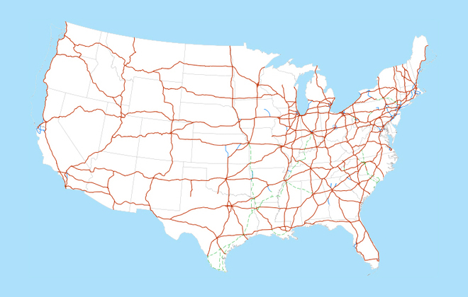
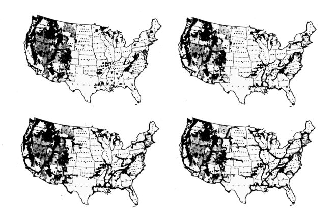
Interstate
-
Interstate
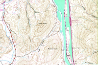
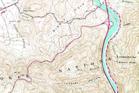
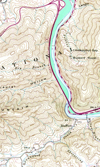
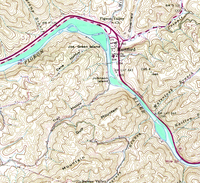
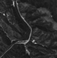
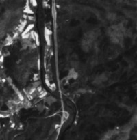
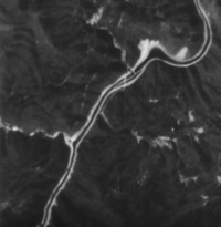
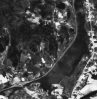
The over 46,000 miles of interstate highway in the United States have long been regarded as a strand of infrastructure on which sprawl accumulates. Most Americans can picture the map of that highway network. Every mile of highway consumes roughly 40 acres of land. Twenty-seven million acres of the 2.3 billion acres of US territory is devoted to transportation networks of all kinds. Less familiar is the map of public lands in the US, even though nearly one third or 650 million acres is publicly held. The highway rights-of-way, thins strips of land vacated for the safety of vehicles traveling at high speeds, are largely featureless. Yet because they are linear and thin they have enormous surface area contacting every region of the country. Interstate overlays the map of public lands and the map of the wayside open land along the interstate highway. Inspired by large linear landscape formations like the Appalachian Trail, the project’s counterfeit USGS maps use the highway as an instrument of land accumulation. While most ideas about the extended wayside take a default position about land preservation and "greening," the project does not necessarily initiate an ecology of preservation. Rather the sites establish a contested territory in the midst of segregated networks—a reservoir of speculation and piecemeal negotiation for a variety of programs. The Interstate is a is capable of adapting its initial neutral protocols into a more flexible differential interface—an interface against which to sponsor a new, diverse series of intelligent national networks.
-
-
-
-
-
Coming soon …
-
-
-
-
-
©2012 The authors and contributors
-